File:Locatie Perzische Golf.PNG
Нахь зэхэщыкIэ ин щыIэп.
Locatie_Perzische_Golf.PNG (Пиксел 652 × 468, файлым иинагъэ: 20 KB, MIME-тип: image/png)
| АгурыбгъэӀон |
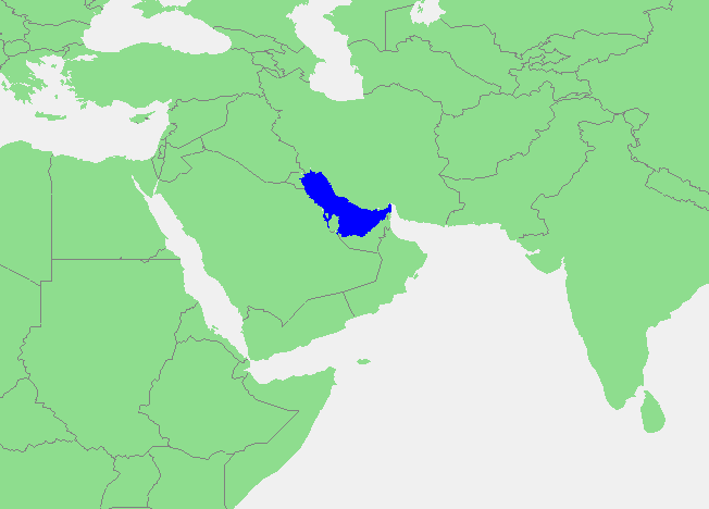
Čeština: Poloha Perského zálivu na mapě Blízkého východu a Indického oceánu |
||||
| КъыздикӀыгъэр | own work based on PD map | ||||
| Аутор | edited by M.Minderhoud | ||||
| Фитыныгъэ (Мы файлым иятӀонэрэ гъэфедэн) |
|
Файл тарихъ
Мафэ/уахътэм теӀункӀ итеплъэр ащыгъум зэрэщытыгъэр плъэгъуным пае.
| Мафэ/Уахътэ | рэсым цӀыку | Иинагъэхэр | Нэбгрэ | ПыӀухьажь | |
|---|---|---|---|---|---|
| джырэ | 22:33, 16 Ӏоныгъу 2006 | | 652 × 468 (20 KB) | Michiel1972 | {{Information |Description= |Source= own work based on PD map |Date= |Author= edited by M.Minderhoud |Permission= {{PD-Demis}} |other_versions= }} category:Locator maps of seas |
Файлым и гъэфедэн
КIэлъыкIорэ нэкIубгъор ещэ мы файлым:
Файлым и глобал гъэфедэныгъэ
Мы файлыр мы викихэм агъэфедэ:
- af.wikipedia.org-м и гъэфедэныгъэ
- an.wikipedia.org-м и гъэфедэныгъэ
- avk.wikipedia.org-м и гъэфедэныгъэ
- ca.wikipedia.org-м и гъэфедэныгъэ
- es.wikipedia.org-м и гъэфедэныгъэ
- fr.wikipedia.org-м и гъэфедэныгъэ
- fy.wikipedia.org-м и гъэфедэныгъэ
- gl.wikipedia.org-м и гъэфедэныгъэ
- gn.wikipedia.org-м и гъэфедэныгъэ
- ia.wikipedia.org-м и гъэфедэныгъэ
- lb.wikipedia.org-м и гъэфедэныгъэ
- pt.wikipedia.org-м и гъэфедэныгъэ
- sc.wikipedia.org-м и гъэфедэныгъэ
- wuu.wikipedia.org-м и гъэфедэныгъэ